By Vince Matthews
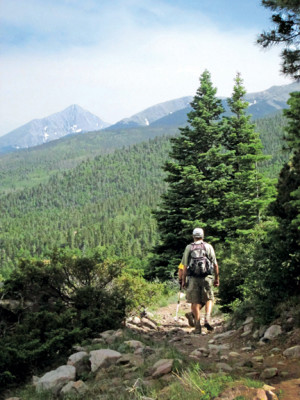
The Rainbow Trail affords an outstanding opportunity to travel through deep time. The trail wends around two of Colorado’s youngest mountain ranges, which together contain 25 of the State’s 58 Fourteeners. The footpath traverses parts of Earth’s crust that record much of Colorado’s 2-billion-year-old history. Faults and folds along the trail record times of crustal deformation. Rocks that were metamorphosed 1.8 billion years ago record Colorado’s oldest-known, mountain-building event. Colorful conglomerates record the 300-million-year-old mountain-building event that gave rise to the Ancestral Rocky Mountains. The high elevations of the Sawatch and Sangre de Cristo Ranges are testaments to the mountain-building event that is currently transpiring. Glacial deposits along the trail record times of great climate change.

The northern end of the Rainbow Trail starts in the Sawatch Range in a very special place geologically – the Bonanza Caldera. And just what, you ask, is a caldera? It is a volcanic feature where huge volumes of material have erupted quickly in the form of ash flows. One such ash-flow eruption from another caldera in the Sawatch Range traveled 90 miles across Central Colorado, reaching Castle Rock on the plains still hot enough to weld together. Because such a huge volume of molten material evacuates the underground so quickly, support for the overlying strata gives way. This causes the surface to subside in a roughly circular depression – the caldera. The collapsed area of the Bonanza Caldera is about 10 miles in diameter. It erupted and collapsed about 33 million years ago. The caldera’s volcanic rocks are most easily recognized by the myriad of white crystals about a quarter of an inch in size. These are evident where the Rainbow Trail begins on the north. And, they are also abundant where the trail descends to Highway 285.
East of Highway 285 the trail soon crosses 1.8 billion-year-old metamorphic rocks of the Sangre de Cristo Range. The rocks that were metamorphosed were older volcanic and sedimentary rocks. As the trail winds around the north end of the Sangres, it follows a fault separating the metamorphic rocks from young sedimentary deposits of the Arkansas Rift Valley which is part of the active Rio Grande Rift System. The rift extends from Texas through New Mexico to northern Colorado.
As you leave the northern end of the range and begin moving down the east flank of the Sangre de Cristos, you will traverse 300 million-year-old rocks of the Sangre de Cristo formation which record the uplift and erosion of the Ancestral Rocky Mountains. The fist-sized cobbles of different rock types in the conglomerates of this formation can provide quite a striking display of colors.
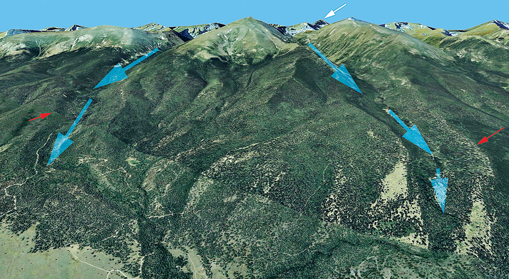
Along the east side of the Sangre de Cristo Range, the trail wanders over many lateral moraines deposited during the last couple of ice ages. Although these moraines are quite obvious when viewing them from a distance, they are not immediately obvious when hiking through heavily wooded terrain. So how do you recognize the moraines? Abruptly, you will come into an area high above a stream that is littered with boulders that may be several feet across. The boulders are of many different rock types. Any layering in the boulders will not be parallel to each other. And, the boulders create a narrow ridge that parallels the intervening creek and trends to the east away from the mountain front.
Although dense forest cover often obscures the geology, a sharp eye should enhance your enjoyment of nature along this beautiful trail.
Vince Matthews lives in Leadville and retired as Director of the Colorado Geological Survey at the end of 2012. He is the editor and Senior author of the multiple-award-winning book, Messages in Stone – Colorado’s Colorful Geology. Each morning he posts a photo and note about the Geology of the Arkansas Valley on Facebook/LeadvilleGeology.