Article, photo and map by Kenneth Jessen
Iris, located in the northern part of Saguache County south of Gunnison, was one of the most remote ghost towns in the state. Until recently, the roads into the area were private, gated and posted. New home construction west of the site has opened up the area to the public.
In 1886, the Grant brothers found free-milling gold ore in this area and started the Denver City Mine. It took three years before they were able to ship any low-grade ore. A second mine, the Dirigo, proved more promising.

In 1894, the gold rush into the area led to the establishment of Iris and another town, Chance, two miles to the northwest. Iris was laid out at the Denver City Mine and was first named Union Hill. The postmaster general insisted on another name. Iris was named for a pretty 10-year-old girl, Iris Heiner, daughter of the register for the land office. By the summer of that year, Iris grew to 20 stores and residences. It had its own newspaper, the Cochetopa Gold Belt, which started publication in June, 1895. It was reported that 1,526 tons of ore had been shipped from area mines. A telephone line was run from Gunnison, about a dozen miles to the north. Starting in October, 1894, the Iris post office opened with tri-weekly mail service.
The following year, 1896, two more grocery stores were added along with a meat market and two more homes. Bob Womack, of Cripple Creek fame, was said to have visited Iris at this time.
The amount invested in area mines far exceeded the value of the ore recovered. It wasn’t long until Iris faded into history only to be reborn with a spurt of new activity in 1901-1902. After this, the post office closed, and only three residents remained. The promising surface depots narrowed down as the mines grew deeper.
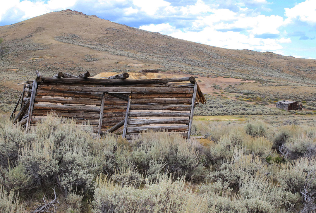
Muriel Sibell Wolle, author of “Stampede to Timberline,” visited Iris in the 1940s after an arduous trip over rough roads. She found about a dozen standing cabins, and cattle grazing in the meadow. By the 1980s, only one cabin stood below the Denver City Mine, two cabins remained in the meadow to the west, plus one lone cabin on the hillside. Today, one of the cabins in the meadow is flat to the ground. The USGS map shows a cemetery to the south of the town, but with no evidence based on a surface examination.
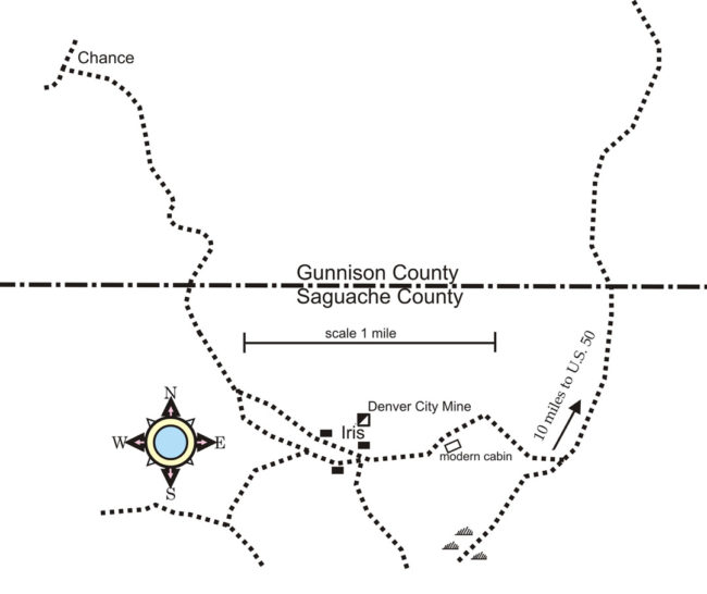
GETTING THERE: The most direct route into Iris is from U.S. Hwy. 50 east of Gunnison on County Road 42. It starts as a good graded road, but just before the climb up to a gravel pit, 42 takes off to the left. The road is rough and branches at County Road 42A. County Road 42A is gated and posted after just three miles. At the end of 42, the road turns to the southwest with a modern house in the distance. A side road up a hillside makes a sharp turn to the left, past a modern cabin leading to a shallow basin. This is Iris, about 10 miles from U.S. 50. The trip requires a vehicle with high ground clearance and good weather.
Historian, lecturer and instructor at Colorado State University, Kenneth Jessen lives in Loveland and is always on the hunt for a “new” ghost town. It took him five attempts to reach Iris due to private property restrictions.


