by Ericka Kastner
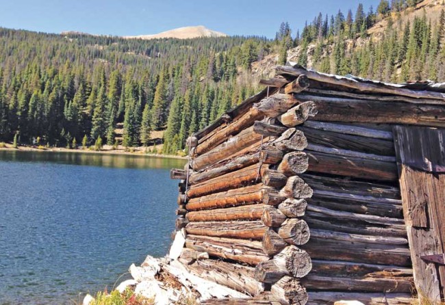
Situated at 10,880 feet in elevation and surrounded by stunning 12,000-foot peaks, Boss Lake is an idyllic spot to spend a day in any season of the year.
Initially built as a reservoir to collect snowmelt and runoff back in the 1890s, the lake has naturally decreased in storage capacity by about 200 acres since then due to the earthen dam on the northeast side of the lake. Terry Scanga, general manager of the Upper Arkansas Water Conservancy District operating and maintaining the reservoir, says there was excess seepage during the 1950s; at that time, the spillway was reduced in height and the dam lost half of its capacity.
Since then, members of the water district (the state of Colorado owns the reservoir) have discussed restoring the dam to its original storage capacity because all existing state reservoirs are nearing their maximum for water storage. Scanga says the Boss Lake project is not a priority for the district since the $1 million needed to do the work would be equal to the cost of the environmental impact statement required before the work could even begin. Funds are not currently available for the restoration of Boss Lake, and the district has its sights set on other larger multiuse projects on private lands.
At one point, the lake had a thriving Brown Trout population, but state officials populated nearby Hunt Lake with endangered native Cutthroat Greenback Trout, and the fish later migrated to Boss Lake. Scanga says these high mountain lakes are ideally situated for endangered species because natural barriers prevent predatory fish from getting in. Unfortunately, according to Scanga, state wildlife officials later learned that the Greenback placed in Hunt Lake were not native species, and there has since been discussion of putting native fish in the lakes. Currently, all fishing in the area is limited to catch and release with flies and lures only. No boat fishing is allowed.
To reach Boss Lake, either as a hike or on snowshoes during winter, travel west from Poncha Springs 12 miles on U.S. Hwy. 50 to FSR 230 (Middle Fork) in the town of Monarch. Parking is available on the north side of Hwy. 50, across from the Monarch Mountain Lodge. Hike or drive approximately 1.4 miles (the road is rough and steep and best travelled in high clearance 4WD vehicles) to the trailhead for Boss and Hunt Lakes.
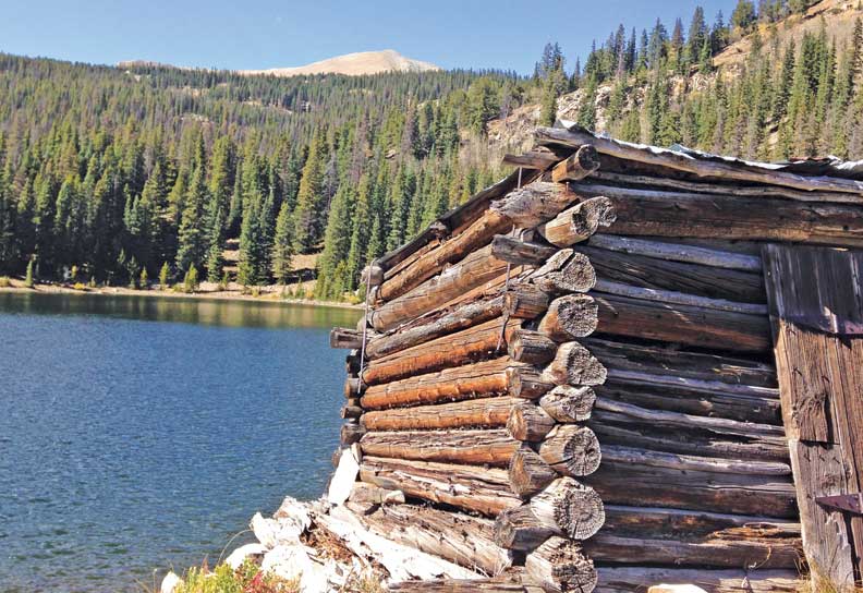
From there, the one-mile rocky singletrack trail to Boss Lake is somewhat steep, but not long, and follows a portion of the Continental Divide Trail. Upon reaching the lake, you’ll first encounter the dam portion of the lake with a historic cabin resting on its flanks. You may either opt to picnic here along the lakeshore, or continue around the lake to the west and travel another mile to the much smaller Hunt Lake just below the Continental Divide at 11,476 feet. Both lakes would make excellent overnight backpacking trips in summer or fall and base camps for backcountry skiing nearby Mount Aetna, Taylor Mountain or Banana Mountain in winter.
Alternately, Boss Lake Road (FSR 235) may be used to access Boss Lake utilizing all terrain vehicles, snowmobiles or on foot, but due to the condition of the road, this route is not advisable for passenger cars or even 4WD vehicles.
Ericka Kastner thinks there’s nothing luckier than getting paid to write about adventures. She is a regular contributor to the Places column, and her work may be viewed online at erickakastner.com.

